
Near the end of the pilot project the platform was starting to bog down, but I still had to use the tools myself to prepare the content for transfer to LSU Atlas (which has been the plan all along). So, I decided to take evasive action and incrementally (but significantly) restructure it. This took a while, and though I'm not 100% done with the work, most of the important stuff is done and the preparation/split, georeference, and trim operations are now back to working. I also made a number of improvements along the way, so here's a quick summary of the changes...
General interface improvements
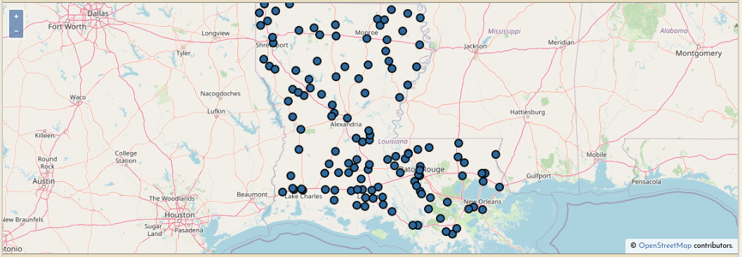
Big home page overhaul including a new map interface (also added to the Browse page) to make it easier to find content, and a nice little "How it works" section.
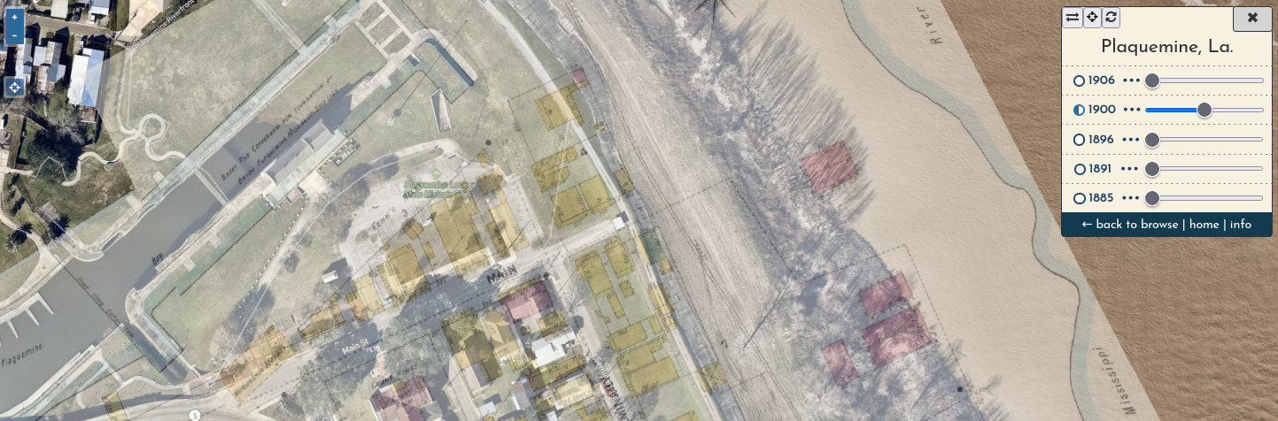
A viewer is now automatically generated for every city, showing mosaic layers for each year (e.g. Plaquemine)
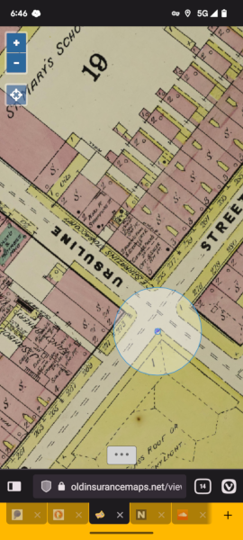
The viewer has a "locate me" button to show your current location. It's fun! I enjoy wandering around the French Quarter while looking at 1885 New Orleans on my phone. This is also how I now tell friends where to meet me for parades:
A new participants page lists session stats for all users
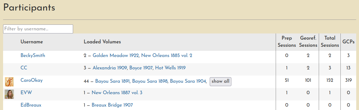
- This is really just a nod at how user engagement could be presented... so much more could be added along these lines (charts, graphs, animated GIFs, who knows??)
Operational differences the keen-eyed observer may notice
- No more user-authored Web Maps, which was a GeoNode feature I am not replicating moving forward
- In this application of GeoNode, the only real function Web Maps served was to facilitate the aggregation of all Sanborn maps for a given city into a single interactive interface, so I decided to automate this instead by creating the single-city viewer (described above).
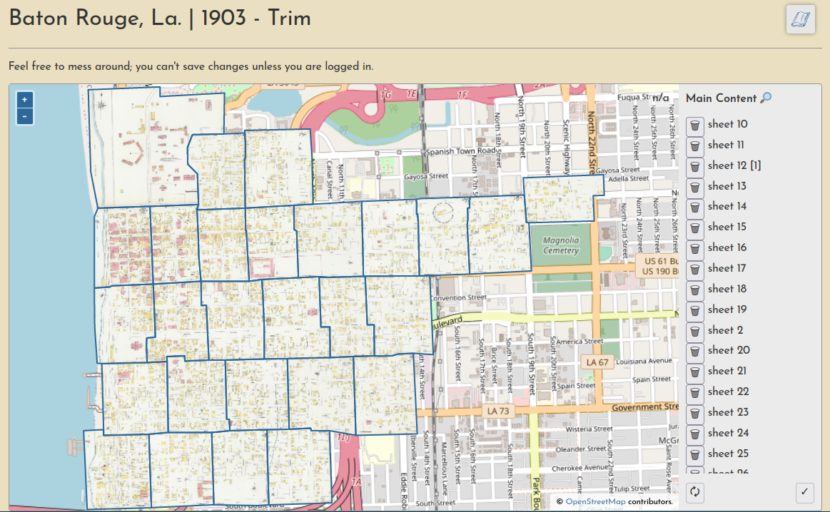
- Trimming is now handled at the volume level, not on a separate page for each layer
- Trust me, this is way better
Notable software updates
- The crux of the restrucuring has been a slow migration from GeoNode and Geoserver to a custom-built CMS and Titiler, respectively.
- I hope to write more about this in the future, especially about using Titiler and its MosaicJSON endpoint. There are so many ways to store, manage, and serve rasters, this project has been a great way to explore new strategies.
- Further integration of Svelte, Openlayers, and Django, a stack I'm really liking and have already started using in other projects.
And a newsletter!
I'm trying out django-newsletter to add a newsletter to the site, LaHMG News, and it's working quitre well. I was able to create an archive from all my past e-mail blasts as well (nice!). Subscribe to be notified about the next blog post!